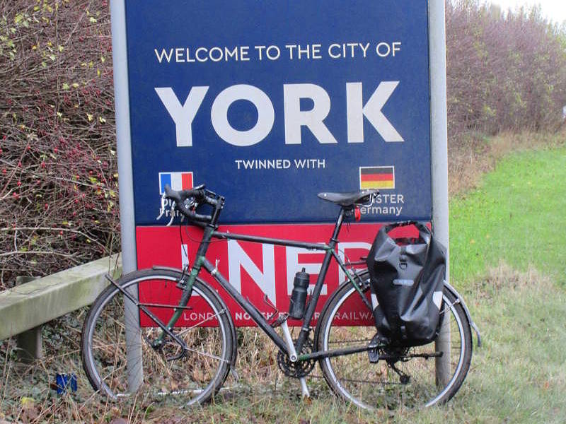
At a loose end last year, I did a home-base End to End of York. At another loose end today, I did a Side to Side. I’m talking the ‘City of York’: the roughly ten-by-ten mile non-metropolitan district within whose boundaries live 203,000 people in 95,000 houses with 235 pubs, 193 churches, 65 supermarkets, 43 streets called ‘something-gate’, 18 bike shops, the National Rail Museum and a Minster.

But today wasn’t about those. Because today I saw a field of alpacas, an actual space rocket, Britain’s own Route 66, a windmill in a housing estate, a miniature Stonehenge, a livestock auction house, and a nuclear bunker. Plus some cafes. Not bad for a modest 17-mile-ish traverse from Rufforth, out near the western extremity of the city limits, through the city centre to Kexby, on the easternmost fringe.
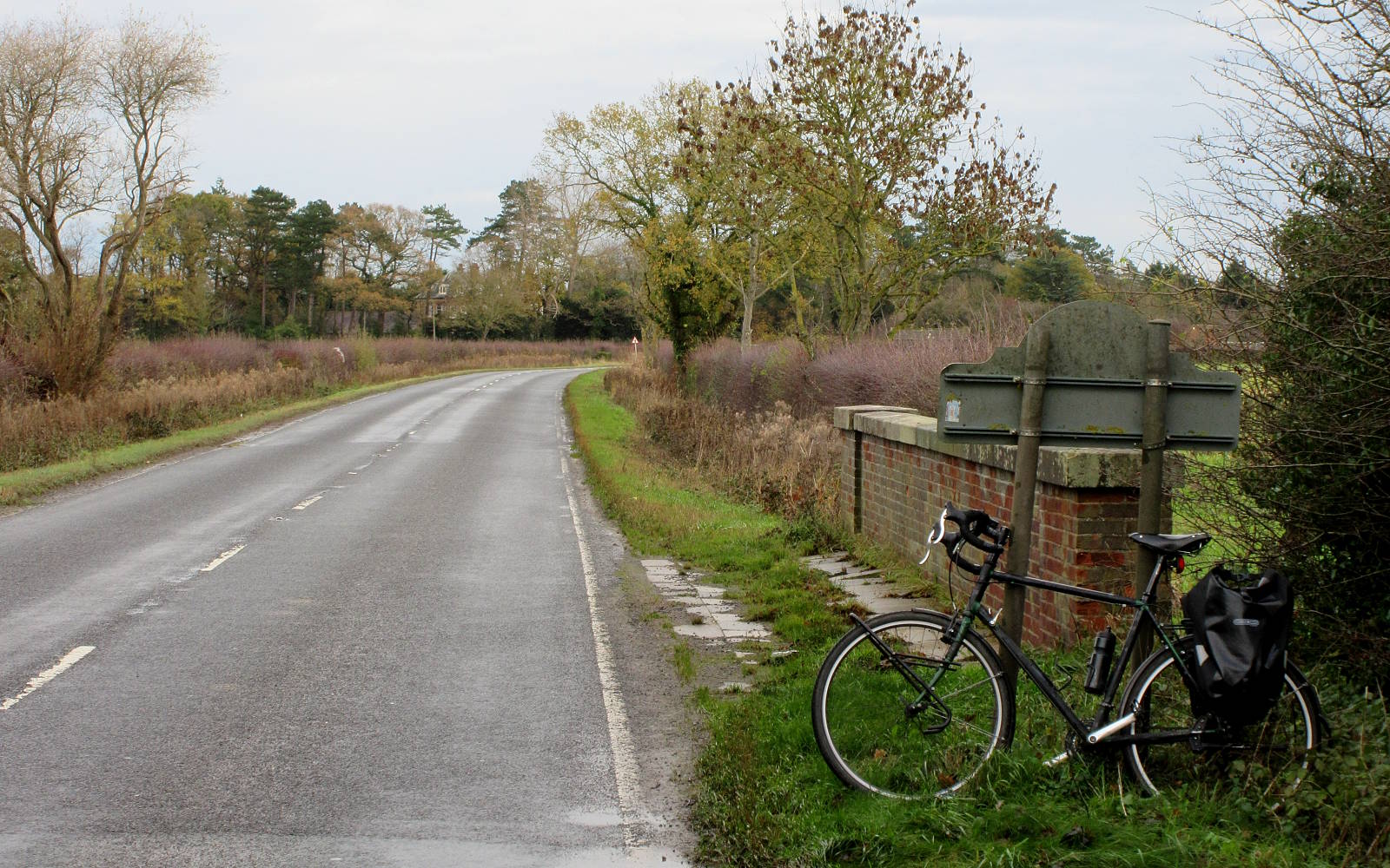
There are, alas, no ‘Welcome to York’ signs where the City begins a mile or so west of Rufforth. Here the B1224 crosses a stream called Moor Drain by the Ordnance Survey and ‘Motor Cut’ by Google Maps. Which goes to prove how (a) inaccurate and (b) car-centric they are.

My miniature odyssey started here, on the bridge by the sign in the opposite direction advising you of your entry into North Yorkshire. I pedalled into Rufforth and thought it was already time for a coffee and cake. The delightful Old School Cafe – already decorated for Christmas – obliged.
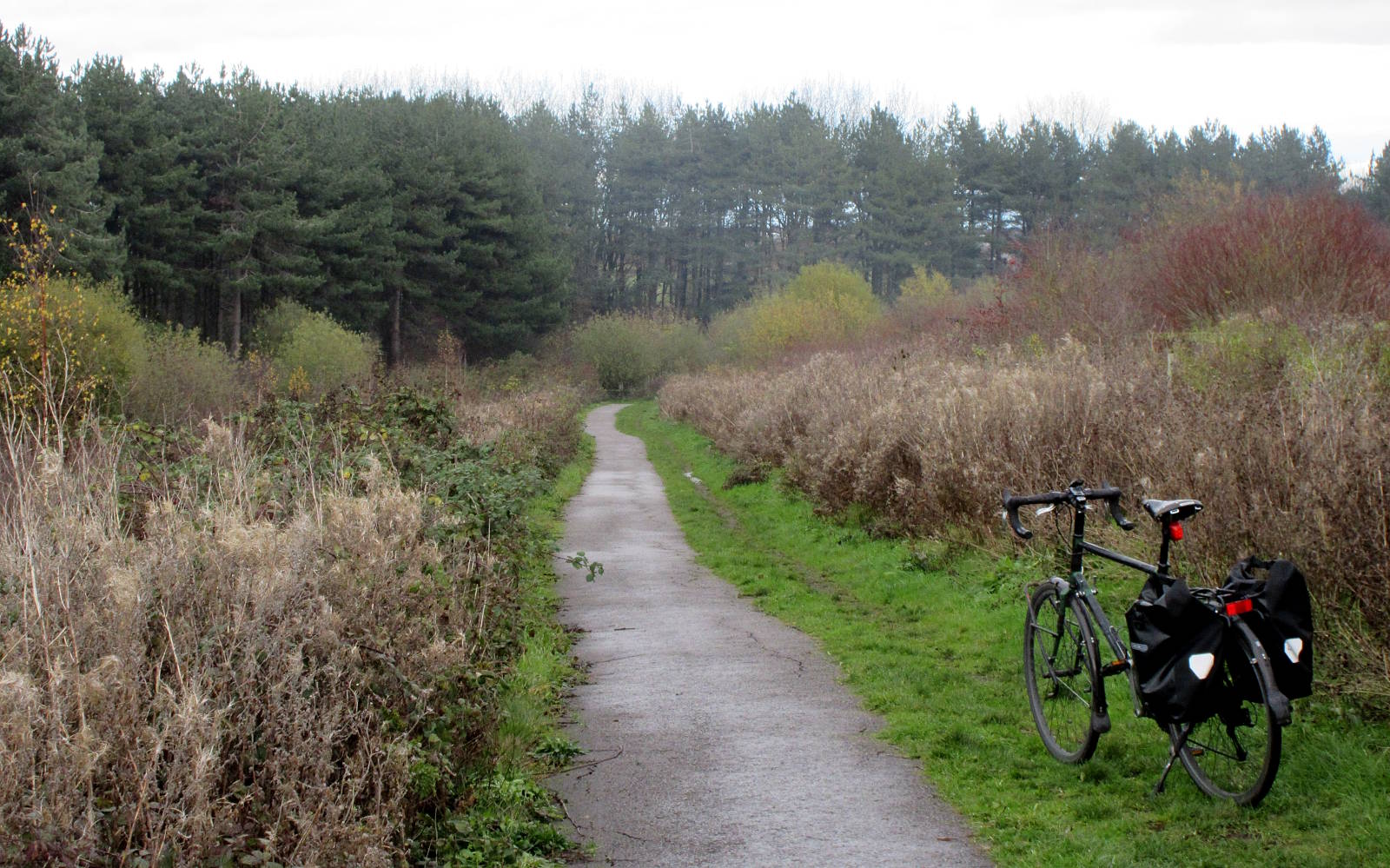
From Rufforth to York’s outskirts I followed the dedicated cycle route that picks its way round the edge of a field and through the old landfill dump of Harewood Whin. It closed in 2019, but didn’t smell like it had.
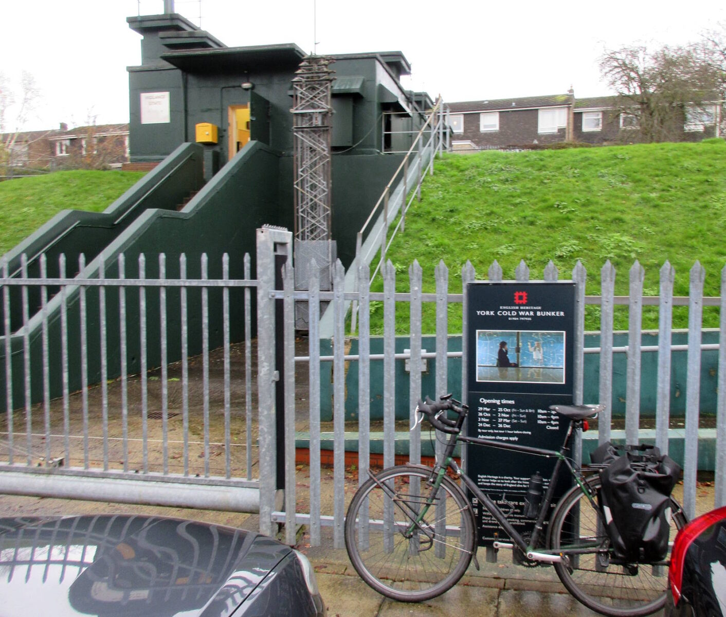
In Acomb I passed the famous Secret Nuclear Bunker. Had the worst come to the worst in the late 20th century, the country could continue to be admistered in refuges such as this. The only problem being there would be no country left to administer.
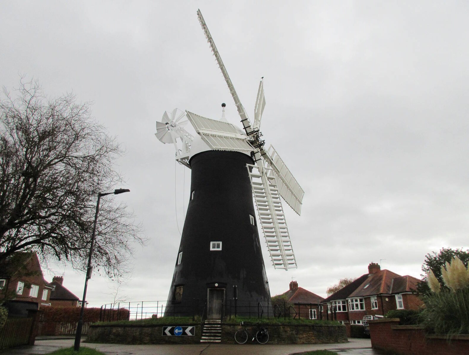
More cheerful was just down the road: Holgate Mill, a restored and working five-sail mill oddly situated in a housing estate. It’s not really on a roundabout, as it’s sometimes described. But that didn’t stop the UK Roundabout Appreciation Society voting it the Best Roundabout of 2012 in the gyratory community’s equivalent of the Oscars.
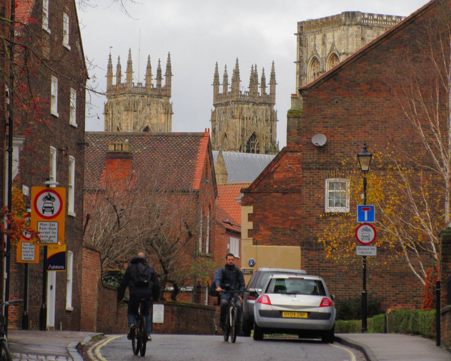
I rode through the new housing development known as York Central, by the National Rail Museum and next to the railway station. The cycle path network here is shaping up to be in the top ten per cent of British bike infrastructure. In other words, not very good. I crossed the Ouse via Lendal Bridge and went slowly alongside the Minster through the throngs of selfie-taking visitors, cutting through Aldwark to Peaseholme Green to see one of my favourite Quirky Things in York…

…A full-size space rocket in the atrium of business insurers Hiscox. It’s a genuine old Russian model, once the fastest ever launched, and supposedly bought online on a whim by Hiscox’s owner.
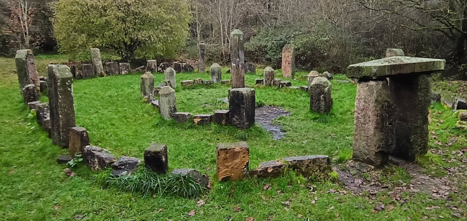
From there I headed east along the Foss Islands railtrail. The eco-centre of St Nicholas Fields is here, and in its grounds is a stone circle: not some ancient mystic henge, but the ‘Dragon Stones’, created in 1995.
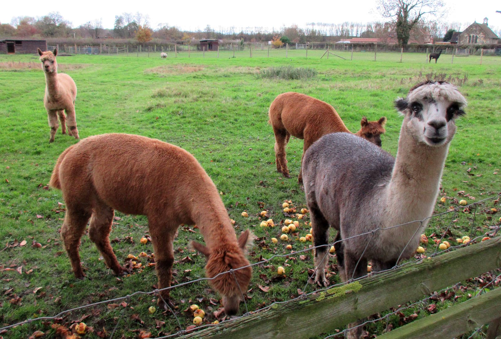
I continued east past the eco-ish development of Derwenthorpe. The path used to be the Derwent Valley Light Railway. In Murton just outside central York there’s an old station and very short stretch of track restored as heritage rail. But I was more interested today in two of Murton’s other claims to fame. First, a field of curious alpacas. Or maybe llamas. No, guanacos. Or are they vicuñas?
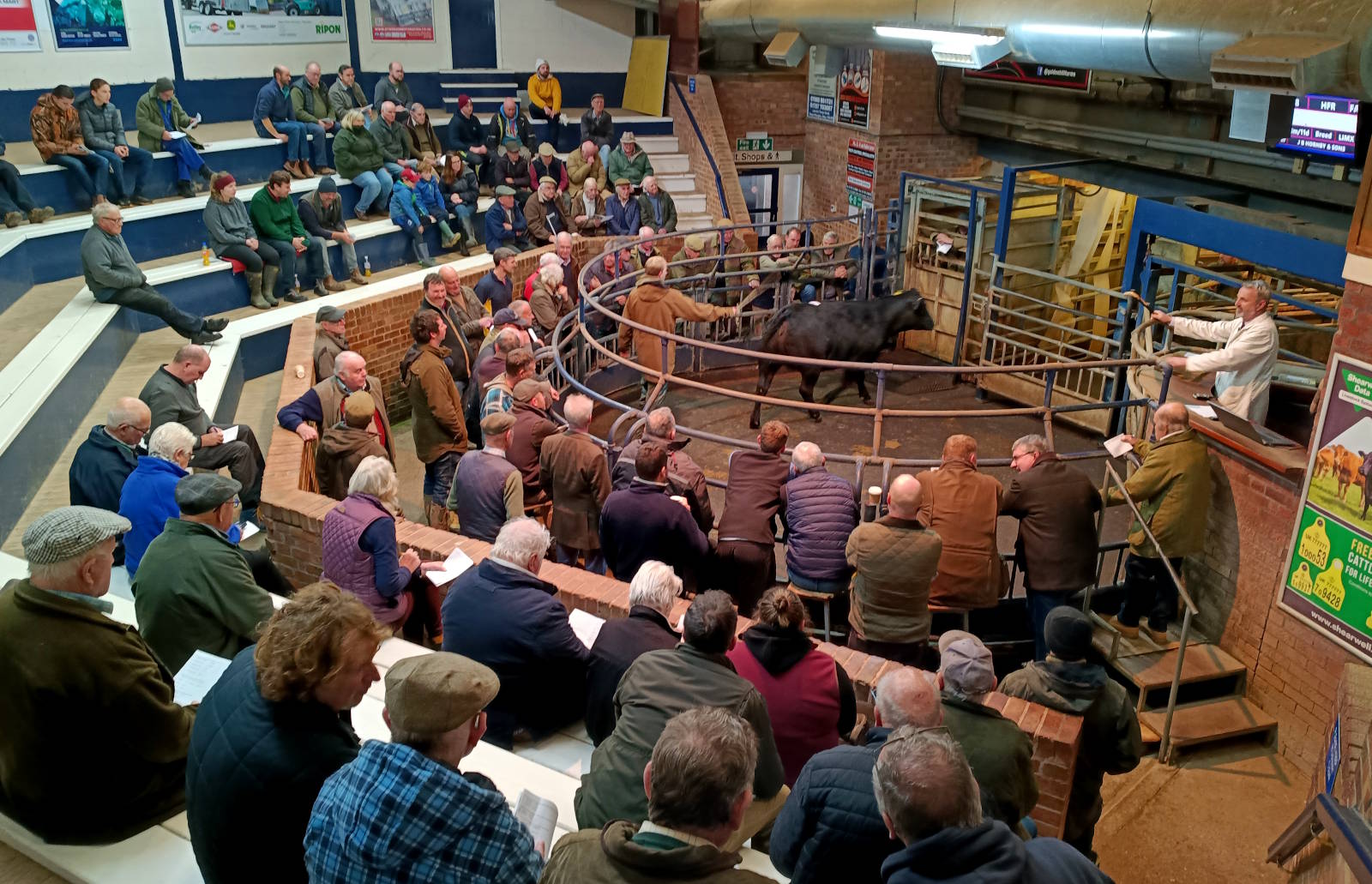
And second, York’s Livestock Auction House. It was doing the business today. Cattle were being paraded brusquely round the ring in front of a wary semicircle of flat-capped farmers, blitzed by an auctioneer’s speed-talking. Utterly incomprehensible to me, but evidently quite clear to the buyers.
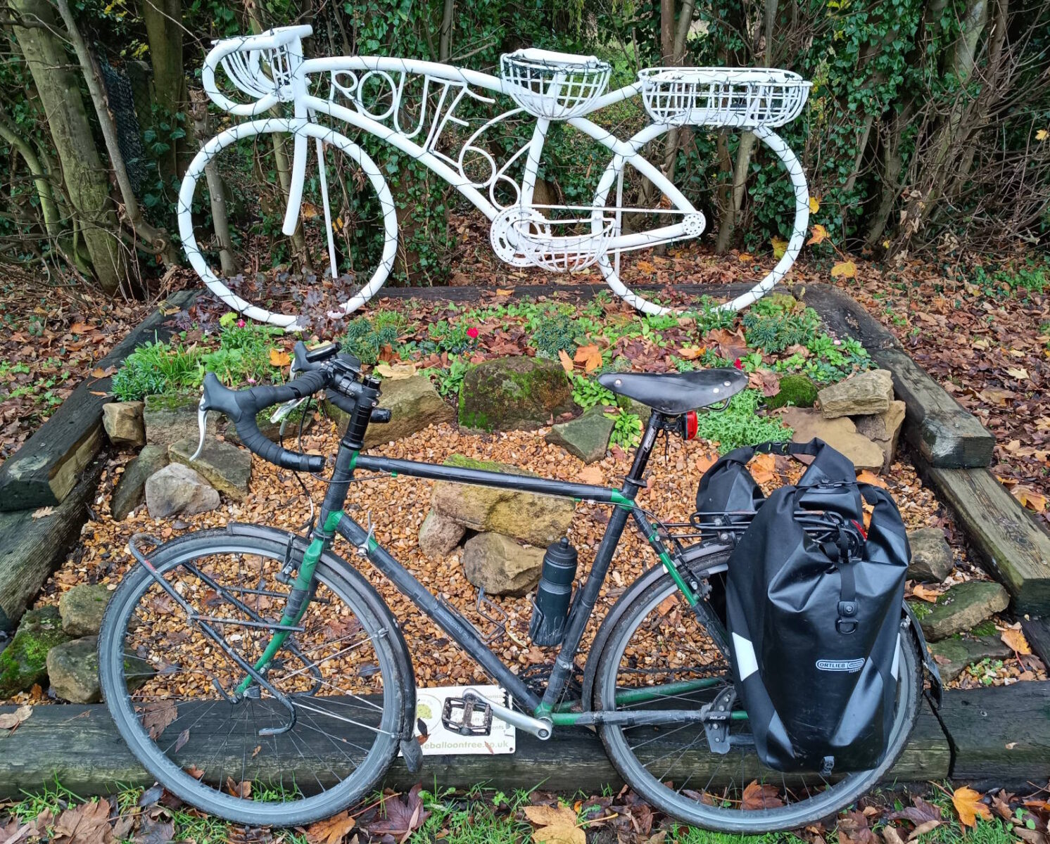
In Dunnington there’s one of my favourite bike route signs in Britain: a white bicycle telling you this is Route 66 (on the National Cycle Network). Get your kicks here.
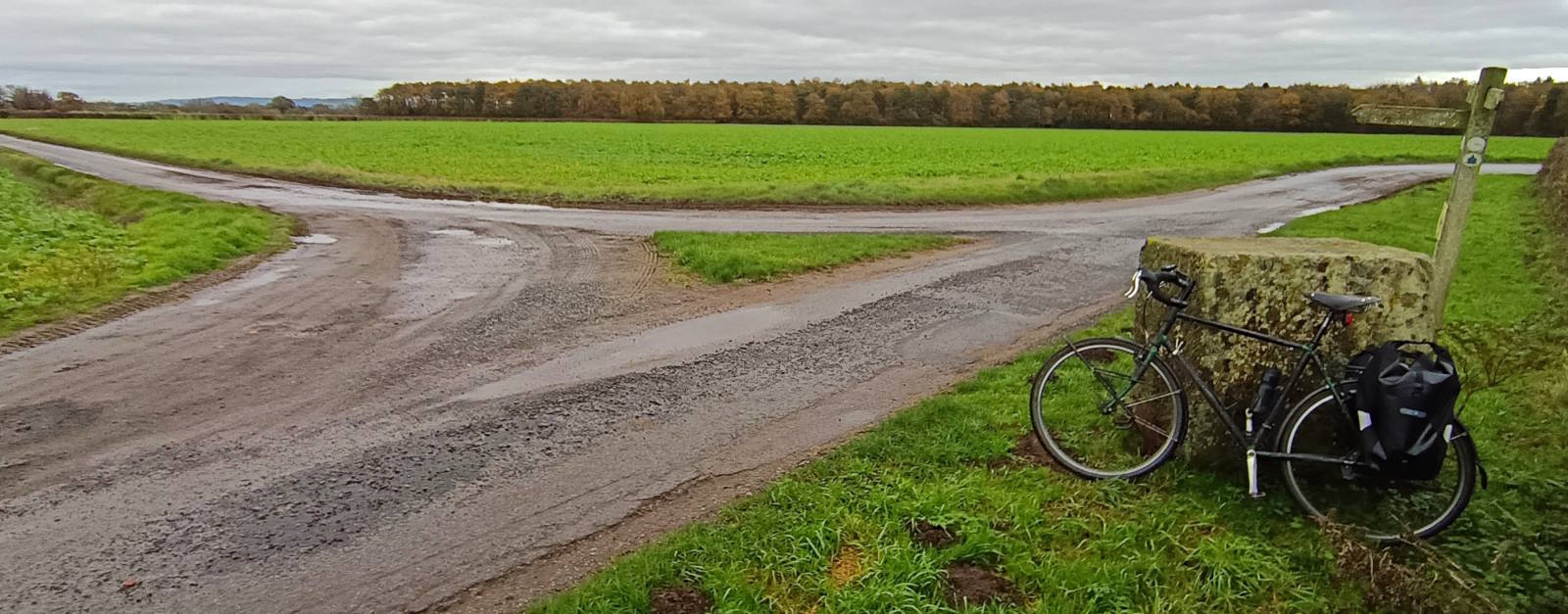
I peeled off Route 66 a mile or two further on, heading south-east on farms roads and tracks and through pleasantly autumnal woods. The last tranche of copper, gold and bronze-coloured leaves carpeted the lane like a, er, carpet.

And so to Kexby, the eastern border of York City, and another bridge over a dividing river. This is the Derwent, which I cycled all of about this time of year in 2019. It was flooded then and was flooded today, though not quite as much this time. Nevertheless, the fields round Kexby Bridge were mostly better suited to growing rice than wheat.

The old bridge – built in 1650 – is now bypassed and closed to traffic. When I came in 2019 there was a nice old sign with the toll charges, but that seems to have disappeared. There’s no border sign here; it’s on the parallel main road bridge where York City finishes and the East Riding begins. (The sign is in the main pic at the top of this post.)

And that was it. The breadth of York, the extent of my home city. A quirky, fun day of easy cycling. All I had to do now was get home. What to do with the rest of the afternoon? I could think of 235 things…
Miles today: 36
Miles Rufforth to Kexby: 17
MAP
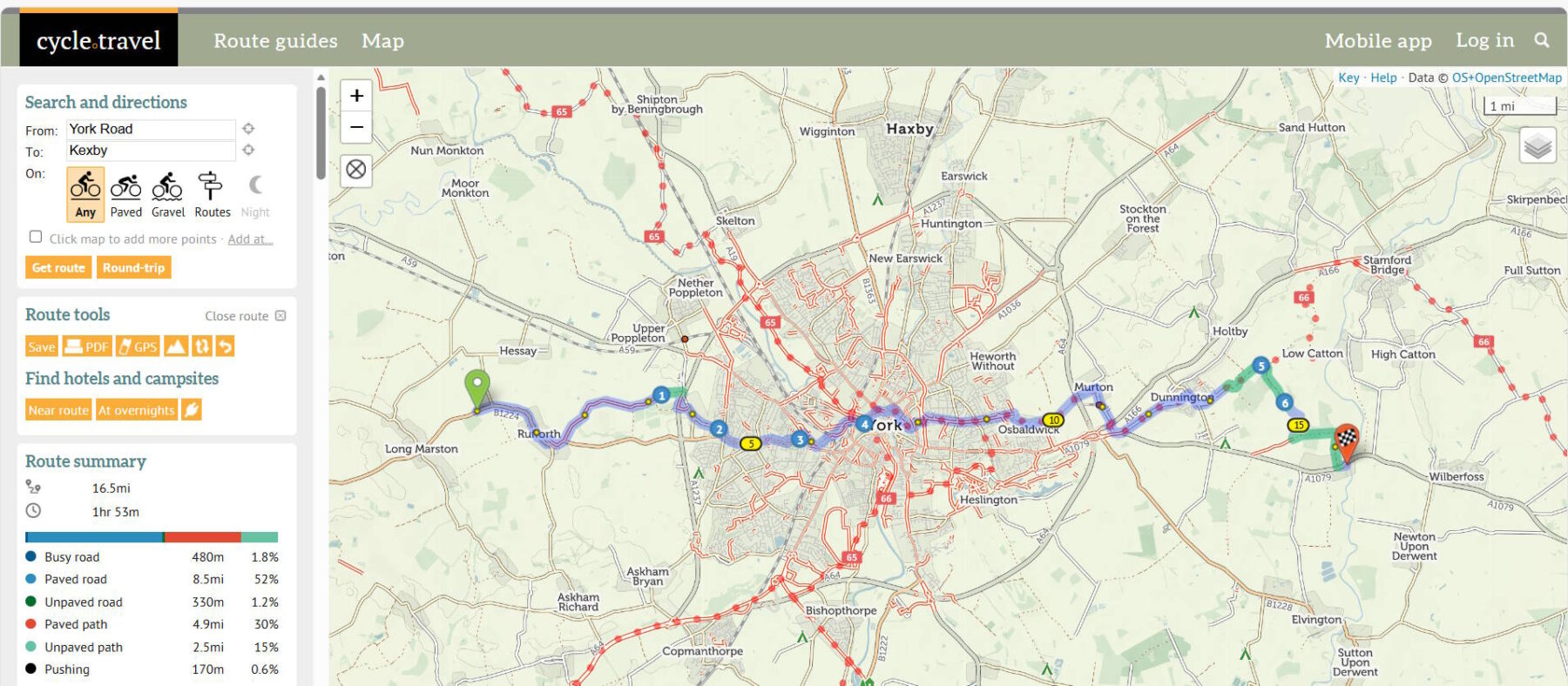
Devised with help from cycle.travel, the best bike route mapping website. You can download the GPX.