The road west over the hills to Applecross, on the north-west coast of Scotland, is Britain’s longest steep hill. Simon Warren’s book on Britain’s top 100 cycling hills rated every one out of ten; this one rated eleven.
And today, fulfilling a long-held ambition, I rode it.
The hill is Bealach na Bà, usually translated ‘Pass of the Cattle’, but I prefer ‘Cow Pass’. Bealach is the Gaelic for ‘pass’, pronounced rather like someone unexpectedly throwing up, which is appropriate.
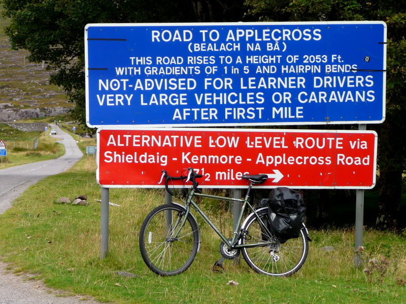
The sign at the bottom – a candidate for Britain’s most verbose –sternly warns learner drivers and caravans off its jackknife hairpins and vertiginous gradients.
The road was built in 1822, and they were clearly made of stern stuff then: it rises from sea level to 616m over a distance of 9km – or 2,053 feet in five and a bit miles in old money – giving it an average gradient of 7%, or 1 in 14 in imperial.
(It was listed in the Guinness Book of Records, as it was then called, as the longest steep hill in Britain for many years, before Guinness went all populist and turfed out stuff like that in favour of yummiest flavours of ice-cream, or the most unicyclists in Santa Claus outfits etc.)
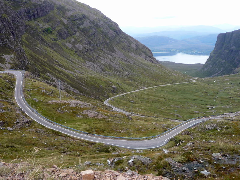
It’s Britain’s most Alpine ascent, getting steadily steeper and steeper as it staircases up the wall of the pass, with the dramatic switchbacks at the top reaching 1 in 5.
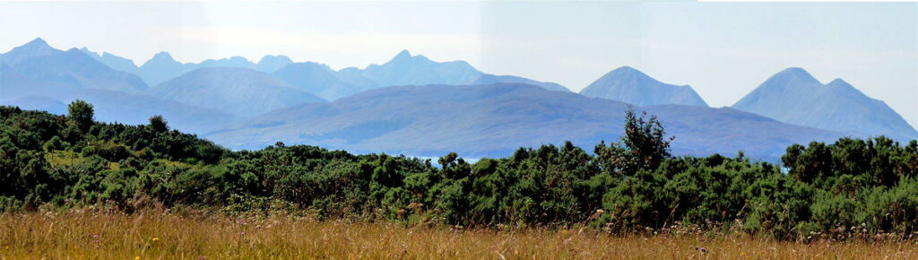
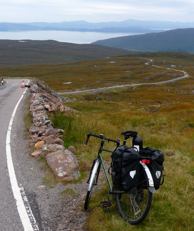
But – today, anyway – it was sheer delight to cycle up, from this tourist’s point of view, stopping frequently to take pictures and swig water, and wave at motorcyclists hurtling to the summit. From the viewpoint at the top you have the magnificent skyline of the Cuillin ridge, keenly observed by people sitting inside motorhomes.
The other side – down to Applecross – is a whizzy adrenaline rush, with good sightlines, mostly easy corners, gentler gradients than the eastern ascent, and long straightish bits: five, maybe six miles of freewheel.
You can see eagles up here, though hopefully you’re looking at the road rather than the sky.
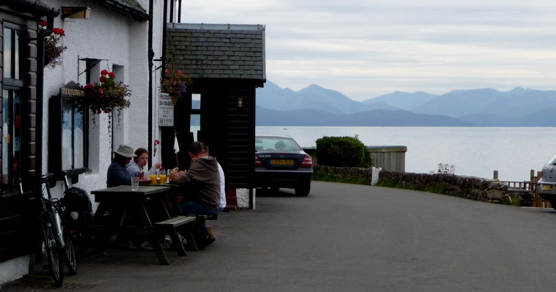
There’s a pleasant pub in Applecross with a beer garden on the edge of the loch, and a fine view of Red Cuillin – that’s the Skye Brewery beer, not the peak.