Here’s a place where the waves rule Britannia. Holy Island is connected to the mainland by a kilometre and a half of tarmac road. Twice a day, the sea gradually rolls in over the marshy surrounding sands and envelops the causeway. It’s rising damp with a vengeance. Lindisfarne becomes Wholly Island.
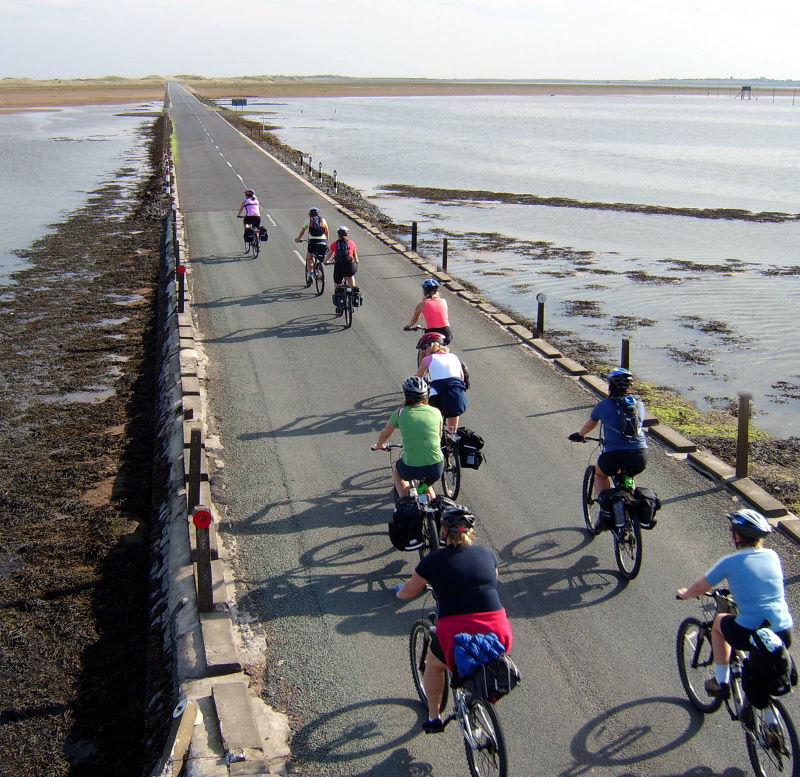
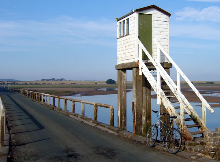
The best way to enjoy the part-time islet and its watery access is by bike. A Sustrans route, the last kilometre or so of it off-road, leads you down the short hop from the junction on the A1, through the village of Beal, to the beginning of the causeway. There’s a small car park and some information boards listing Safe Crossing Times for the next few days. A few hundred metres along the causeway is a wooden box on stilts. This is the refuge for overcasual timekeepers who have unexpectedly gone paddling. It’s a cosy little place, but five hours in it might get tedious. It has a door, bench, south-facing window, emergency phone, and lists of taxi and car hire firms in case your intended means of transport is now inconveniently floating towards another Shipping Forecast area.
Do your homework, and choose a day when the last Safe Crossing Time for an incoming tide is sometime in the afternoon. Schedule your arrival to allow an hour or two on the island before the last SCT. From the mainland to the island’s village centre it’s only about 20 minutes’ ride. The big-skied roll across is a special experience in itself: the grassy dunes and sands are a nature reserve, and there’s that salty-breezed, North-Sea feel to the landscape similar to that of the Danish and Dutch coasts.
Do what you have to do on the island – visit the Castle, go nature-trailing, watch birds, briefly toy with the idea of intentionally stranding yourself in the pub, whatever. But aim to start cycling back round about the last Safe Crossing Time. They err very much on the side of caution; you’ll have well over an hour to do your 20-minute return trip before any part of the road gets remotely moist.
Safely back on the mainland, at the car park, curious onlookers will be gathering to watch the tide come in, especially if it’s a sunny weekend.
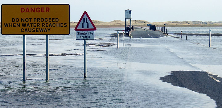
Now the fun begins. The stretch between here and the refuge is the lowest-lying, and the one that goes under first. You can dawdle your way up and back several times to the refuge, crossing the small bridge that crosses a creek just before it, and watch the water infiltrate the sands imperceptibly. It’s hard to believe that the white-horse breakers you can see on the distant north horizon will ever make it this far. But two hours from now they will.
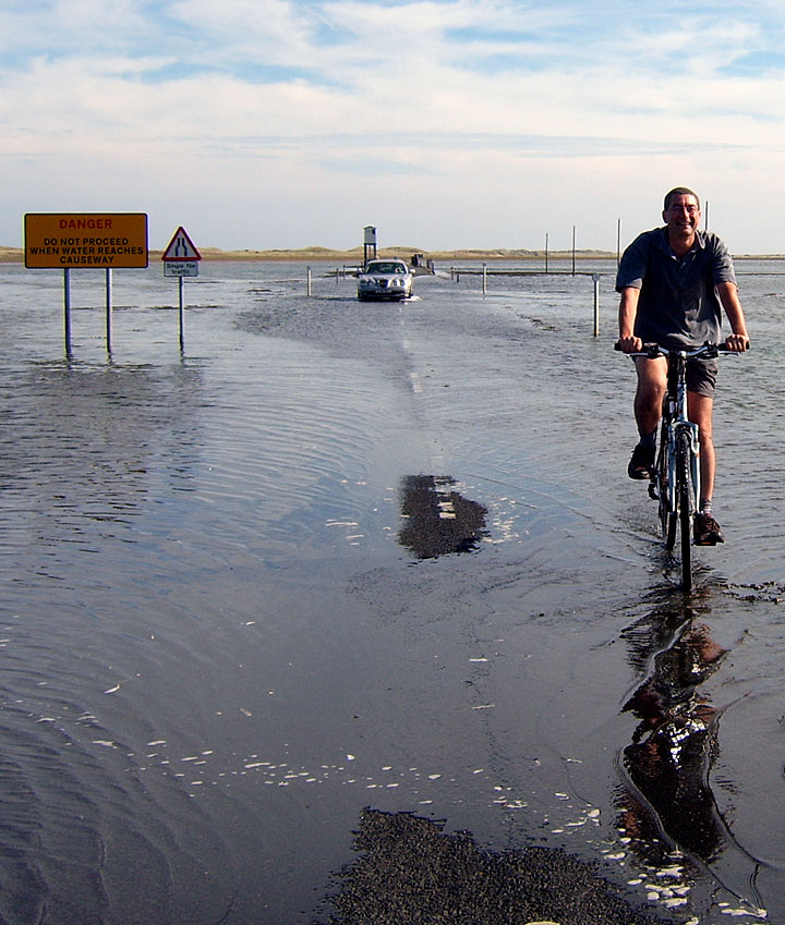
There’ll be a regular procession of cars blithely ignoring the Safe Crossing Times. You can see why they’re tempted. Over an hour after the SCT, the water might only just be lapping on to the blacktop, and its progress might seem as gentle as a paddling pool filled from a watering-can.
Some of the late crossers are clearly locals who know the tides like the back of their hand, and exactly how hairy both can be. Others are daytrippers pushing their luck, some to ludicrously risky lengths. You can feel smug about how terrible all that corrosive salt water is for their car as they slosh through it in their panicked dash for safety. You’ll make a mental note to thoroughly rinse off your own drive train as soon as you can, which you will then forget about, until two days later your chain turns russet and is so noisy it’s attracting corncrakes.
Aquaplane happily around on your bike and see which car drivers are going to get caught big time. Stick to the area between the refuge and the mainland, where all the observers hopeful of seeing the refuge become occupied will be concentrated anyway, and you can’t really go wrong.
The waves nibble away at the road, gradually turning asphalt into marine biology. Quite a sight. If the tide only came in once a year, it would be a must-see natural phenomenon on a par with a solar eclipse; the fact that it happens so regularly and so predictably shouldn’t make it any less awesome.